
Ride with GPS Unveils Revolutionary 3D Mapping Feature
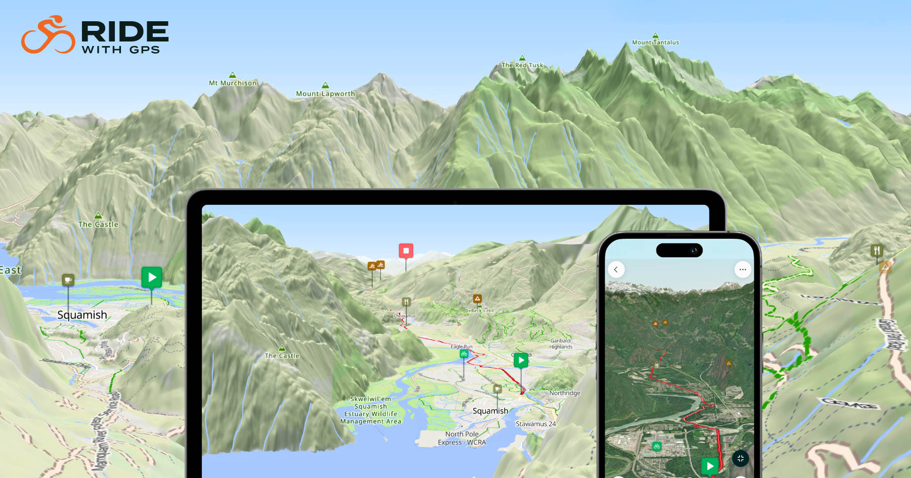
In a significant advancement for cycling navigation, Ride with GPS has introduced its innovative 3D Maps feature, now available on both web and mobile platforms. This enhancement offers cyclists a dynamic and immersive way to visualize their routes, transforming traditional flat maps into interactive, three-dimensional experiences.
A New Dimension in Route Planning
Historically, cyclists have relied on two-dimensional maps, often requiring imagination to interpret elevation changes and terrain features. Ride with GPS’s 3D Maps address this limitation by allowing users to tilt, rotate, and zoom into their routes, providing a realistic preview of the terrain they will encounter. This feature is particularly beneficial for assessing challenging climbs, descents, and intricate switchbacks, enabling riders to prepare more effectively for their journeys.
Enhanced Planning and Navigation
The 3D Maps feature is designed to integrate seamlessly into the existing Ride with GPS ecosystem, enhancing three key aspects of cycling:
-
Preview in 3D: Before embarking on a ride, cyclists can explore the route in three dimensions, gaining a clear understanding of elevation profiles and potential challenges. This visual insight aids in making informed decisions about the ride’s difficulty and suitability.
-
Plan in 3D: During the route planning phase, the 3D visualization helps identify tough sections, allowing riders to adjust their plans to include additional climbs or to avoid particularly demanding areas. This interactive approach makes the planning process more engaging and tailored to individual preferences.
-
Navigate in 3D: While on the road, the 3D Maps feature provides real-time terrain context, offering turn-by-turn directions that reflect the actual landscape. This ensures that cyclists are not only guided accurately but also have a clear understanding of the terrain ahead, enhancing both safety and enjoyment.
Comprehensive Map Integration
The 3D Maps feature is compatible with various map styles, including Ride with GPS Cycle, OSM-based maps, ESRI Topo, and USGS-based styles. Additionally, satellite imagery is available on mobile devices, offering even more detailed terrain information. This versatility allows cyclists to analyze routes using their preferred map style and switch between them for a comprehensive understanding of the terrain.
Availability
Cyclists can explore the new 3D Maps feature by visiting the Ride with GPS website or by updating their mobile app to the latest version. This enhancement marks a significant step forward in cycling navigation, providing riders with the tools to experience their routes in a more immersive and informative manner.
For more information and to start using 3D Maps, visit Ride with GPS.