
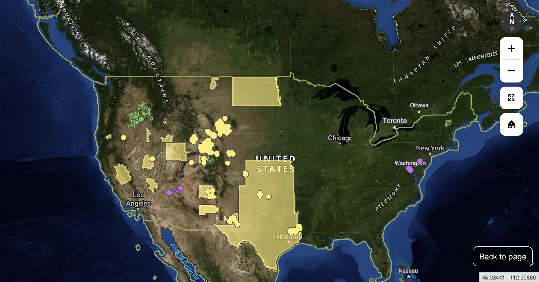
onX Maps has unveiled a groundbreaking tool designed to empower outdoor enthusiasts and conservationists alike: the Public Land Comment Map. This innovative web application offers a comprehensive, interactive platform that not only highlights current public comment periods on federal public lands but also provides in-depth insights into the decision-making processes of key federal agencies.
A Unified Platform for Public Engagement
The Public Land Comment Map serves as a centralized hub, aggregating data from the Bureau of Land Management (BLM), United States Forest Service (USFS), National Park Service (NPS), and U.S. Fish and Wildlife Service (USFWS). Collectively, these agencies oversee over 673 million acres of public land across the United States. By consolidating information from these diverse sources, the map simplifies the process for users to identify and participate in public comment periods affecting public lands.
Interactive Mapping for Informed Participation
One of the standout features of the Public Land Comment Map is its interactive mapping capability. Users can visualize specific areas impacted by proposed agency decisions, allowing for a more personalized understanding of how these proposals may affect lands they frequent for activities such as hiking, biking, camping, and fishing. By clicking on highlighted regions, users are directed to official pages where they can submit comments directly to the respective agencies, fostering a more engaged and informed public.
Educational Resources for Effective Advocacy
Beyond its mapping functionalities, the Public Land Comment Map offers a wealth of educational resources aimed at enhancing the effectiveness of public comments. Recognizing that well-informed and thoughtfully crafted comments are more likely to influence agency decisions, onX provides guidance on understanding the cadence of agency actions and strategies for submitting impactful feedback. This educational component ensures that users are not only aware of ongoing comment periods but are also equipped to participate meaningfully in the decision-making processes that shape the future of public lands.
A Call to Action for Outdoor Enthusiasts
The launch of the Public Land Comment Map underscores onX Maps’ commitment to promoting transparency and public involvement in land management decisions. By providing a user-friendly platform that combines interactive mapping with educational resources, onX empowers individuals to take an active role in preserving and enhancing the public lands they cherish. Whether you’re an avid hiker, cyclist, or conservation advocate, this tool offers a streamlined pathway to ensure your voice is heard in the stewardship of America’s public lands.
For more information and to explore the Public Land Comment Map, visit onX Maps’ official website.